 Waterford City Metropolitan District: Tramore
Tramore combines the open character of a long Atlantic beach with the close-knit feel of a traditional Irish seaside town in a way that reflects its position on Tramore Bay in County Waterford. Its name derives from the Irish Trá Mhór, meaning “big strand”, an apt description of the broad sandy shore that curves around the bay. A promenade follows the waterfront, while green farmland and low coastal hills frame the town. Tramore developed as a resort during the 19th century, and the Metal Man, a sailor-shaped beacon on Newtown Head, was erected in 1823 after the wreck of the Sea Horse. Today the bay remains central to local life, drawing walkers, swimmers and surfers to Ireland’s southeast coast.
Generated by AI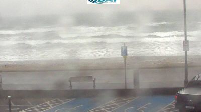

Waterford City Metropolitan District lies along the River Suir in southeast Ireland, where a broad tidal waterway meets a compact urban centre shaped by its port and the Munster lowlands. Waterford was founded by Vikings in 914, a legacy explored in the Viking Triangle, the historic quarter around Reginald’s Tower. The tower is a prominent remnant of the city’s medieval defences, while the Medieval Museum traces Waterford’s civic and religious past. Local crystal-making dates to 1783 and remains central to the city’s international identity. Quays, bridges and streets on both sides of the Suir give Waterford a distinctly riverside character. Explore nearby webcam locations that provide complementary perspectives on Waterford and the River Suir.
1 webcam
Munster stretches from the Atlantic coast and its long peninsulas to Waterford Harbour in the southeast, encompassing rugged shores, fertile pastureland and wide river valleys. The River Shannon and its estuary shape the region around Limerick, while the Blackwater runs through the southern counties. The Dingle and Iveragh peninsulas give western Munster its distinctive Atlantic character, and Killarney National Park is known for its lakes and mountain setting. Inland, the medieval Rock of Cashel remains one of Ireland’s most recognisable historic sites. Move on to other webcams in the region to compare landscapes and settings around Munster.
12 webcams
Atlantic coastline defines much of Ireland — its harbours, pastureland and maritime routes have long supported fishing, farming and trade. The River Shannon crosses the island’s interior, while the west is marked by the Cliffs of Moher and the limestone terrain of the Burren. Dublin combines Georgian streetscapes with institutions such as Trinity College, home to the Book of Kells. Far older still is Newgrange, a Neolithic passage tomb in County Meath whose winter-solstice alignment reflects the island’s prehistoric past. Irish traditional music remains central to pub sessions and festivals, and the Irish language is spoken in designated Gaeltacht areas. Explore nearby webcam locations that provide complementary perspectives on Ireland’s Atlantic coast and inland towns.
30 webcams