 Tenri: Weather&Traffic of the MEIHAN highway at Ipponmatu ~ Hari NARA JAPAN名阪国道一本松~針の様子
Tenri has served as the centre of Tenrikyō in Nara Prefecture since the late 19th century. The city lies on the eastern side of the Nara Basin, beneath the wooded uplands of the Yamato Plateau. It grew around Tenrikyō, a Japanese religion founded in 1838 by Nakayama Miki; its headquarters complex remains central to the city’s identity. Farther east, the Hari district belongs to Nara City and is crossed by National Route 25, the Meihan National Highway, an important road corridor between the Kansai region and Mie Prefecture. Here, the basin’s denser urban fabric gives way to forest-lined slopes and the more elevated terrain of eastern Nara.
Generated by AI
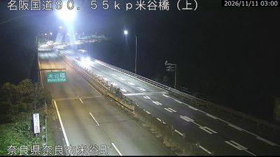




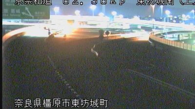

Among the cities of Nara Prefecture, Tenri stands out for being the spiritual centre of Tenrikyo, a Japanese religious movement founded by Nakayama Miki in 1838. Set on the eastern side of the Yamato Basin, the city marks the transition from Nara’s broad lowlands to wooded foothills. The ancient Yamanobe-no-michi route runs through Tenri, passing rural fields, burial mounds and shrines, including Isonokami Shrine, one of Japan’s oldest Shinto sanctuaries. Around Tenrikyo Church Headquarters, the vast Oyasato-yakata precinct gives the centre an unmistakably institutional scale. Browse additional webcams from the surrounding area to extend your view of the Yamato Basin.
4 webcams
Nara Prefecture has been a historic heartland of Japan since antiquity. Its northern basin centres on Nara, Japan’s capital from 710 to 794, where Tōdai-ji’s Great Buddha and the temple precincts of Nara Park recall the early Buddhist state. Southward, the land rises into the forested Yoshino Mountains, and the Yoshino River crosses this interior before becoming the Kinokawa in Wakayama. Yoshino is closely associated with spring cherry blossoms, while ancient pilgrimage routes traverse the southern mountains towards the sacred sites of the Kii Peninsula. Browse other webcams across Nara Prefecture to place this setting in Japan’s wider geographic context.
13 webcams
Among the countries of East Asia, Japan stands out for its volcanic archipelago, stretching from the cool north of Hokkaido to subtropical Okinawa. Mount Fuji, the nation’s highest mountain, rises above central Honshu, while the Pacific Ocean and the Seto Inland Sea have long shaped settlement, fishing and travel. Tokyo pairs dense urban life with major museums and neighbourhood traditions; Kyoto preserves temples, gardens and the legacy of Japan’s imperial court. Seasonal customs give journeys a changing rhythm, from spring cherry blossom viewing to autumn leaves. Regional cooking is equally varied, with sushi, ramen and local specialties reflecting coastlines, climate and agriculture. Explore nearby webcam locations that provide complementary perspectives on Japan’s islands, cities and mountain regions.
1.3K webcams