 Apple Tree Creek: Childers
The Isis River catchment defines the setting of Childers — fertile inland country between the coast and the Burnett hinterland has shaped its long association with sugarcane. Churchill Street forms the town’s civic and commercial spine, lined with mature street trees, angled parking and substantial early twentieth-century shopfronts. Childers developed as a service centre for farms and mills in the Isis district, and its broad main street retains the scale of a regional Queensland town. The Palace Backpackers fire of 2000, in which 15 people died, remains a defining and solemn part of local memory; the Childers Palace Memorial offers a place of reflection. Today the town combines agricultural trade with cafés, galleries and heritage buildings.
Generated by AI



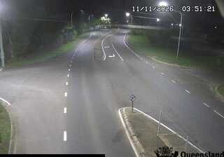


Tucked into the sugarcane country around Apple Tree Creek in Queensland’s Wide Bay–Burnett region, Apple Tree Creek is a place whose character is shaped by subtropical agriculture and its location near the coast. The small settlement sits on the Bruce Highway, south of Childers, amid a working rural district of cane fields, grazing land and scattered forest. Apple Tree Creek itself gives the locality its name and reflects the waterways that cross this low-lying part of coastal Queensland. Sugar production has long helped define the surrounding Childers district, linking local farms with the region’s transport routes and towns. Continue with other webcams from the area to see how this part of Wide Bay–Burnett connects regionally.
1 webcam
Queensland extends from Torres Strait in the north to the New South Wales border in the south, encompassing a tropical coastline and a vast, dry interior. Along the Coral Sea, the Great Barrier Reef runs beside the state’s eastern shore, while inland plains, grazing country and long distances define much of central and western Queensland. This location lies in the interior, where settlements are widely spaced and open outback horizons contrast with the humid coast. Queensland is home to Aboriginal and Torres Strait Islander peoples, whose enduring connections to Country underpin its cultural identity. Browse additional webcams from central Queensland to extend your view of the state’s interior.
482 webcams
Australia’s terrain extends from tropical rainforests in the northeast to arid plains in the interior, producing dramatic climatic contrasts. The Great Dividing Range follows much of the eastern coast, while the Great Barrier Reef lies off Queensland in the Coral Sea and Uluru rises from the central desert. Aboriginal and Torres Strait Islander peoples maintain living cultures whose connections to Country long predate European settlement. In Sydney, the sail-like Opera House, completed in 1973, stands beside one of the world’s best-known harbours. Discover further points of interest through webcams located across Australia.
1.6K webcams