 Kunje: Busat: Uvala maslina - Utjeha - Adriatic Sea
Tucked along Montenegro’s southern Adriatic coast, Kunje is a place whose character is shaped by the sea and olive-covered slopes. This small settlement lies close to Uvala maslina–Utjeha, a coastal bay south of Bar, where homes and holiday accommodation are set among Mediterranean vegetation above the Adriatic Sea. The name Uvala maslina means “Olive Bay”, referring to trees long associated with this stretch of coast. Kunje forms part of the more residential Bar Municipality shoreline rather than a historic urban centre, with buildings spread across low ground and hillsides towards the water. The open sea defines everyday life here, while Montenegro’s rugged coast continues south towards Ulcinj.
Generated by AI
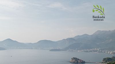

Built around a short stretch of Montenegro’s Adriatic coast, Kunje has grown into a small settlement in Bar Municipality. It lies between the towns of Bar and Ulcinj, where low coastal slopes descend toward the Adriatic Sea and the inland terrain rises toward the Rumija range. The setting is more residential than urban, with the rhythm of the coast shaping daily life. Bar Municipality has a long olive-growing tradition, while Stari Bar, its historic fortified town, stands inland below Mount Rumija. Kunje is a quiet base for understanding Montenegro’s southern coast and its contrast between sea, hills and old settlements. Explore nearby webcam locations that provide complementary perspectives on Bar Municipality.
1 webcam
Bar Municipality has functioned as a coastal crossroads within Montenegro since antiquity. It extends from the Adriatic shoreline through Mediterranean slopes beneath the Rumija range toward the Lake Skadar basin, creating a distinct contrast with the country’s high mountain interior. The port city of Bar is Montenegro’s principal maritime port and an important connection for coastal road and rail routes. Above the modern town, Stari Bar preserves a fortified historic settlement, where stone lanes, mosques, churches and an Ottoman aqueduct reflect centuries of changing rule. Olive growing remains central to local identity, particularly on the coastal plain. Explore additional webcams nearby to better understand how Bar Municipality connects with the Adriatic coast and Lake Skadar hinterland.
2 webcams
Montenegro occupies a rugged Adriatic coast and mountainous interior in southeastern Europe. The Bay of Kotor cuts deep into the shore beneath steep slopes, while Durmitor National Park protects high Dinaric terrain and the Tara River canyon. Kotor’s fortified old town, shaped during centuries of Venetian rule, is a UNESCO World Heritage site; its lanes and squares contrast with the beaches around Budva. Inland, Lake Skadar forms part of the border with Albania and supports an important wetland ecosystem. Orthodox monasteries, Ottoman-era traces and a strong café culture reflect the country’s layered past. Find related webcams in the surrounding area to build a fuller picture of Montenegro’s coast and mountains.
11 webcams