 Iwonicz-Zdroj: Pl. Dietla, Iwonicz-Zdrój - Altana Glorietka - Park Zdrojowy
Among the spa towns of the Subcarpathian Voivodeship, Iwonicz-Zdrój stands out for its long-established health-resort quarter set among the wooded foothills of the Beskid Niski. Park Zdrojowy and Plac Dietla form the social centre of the resort, with paths, formal planting and historic spa buildings arranged below a forested slope. The Glorietka is an ornamental pavilion in this park setting, and the square is used for gatherings and cultural events. Iwonicz-Zdrój is one of Poland’s oldest spa resorts; the use of its mineral waters was recorded in the 16th century. Plac Dietla commemorates Józef Dietl, a physician regarded as a founder of modern Polish balneology.
Generated by AI



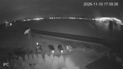


Built around mineral springs, Iwonicz-Zdrój grew into one of Poland’s longest-established health resorts in the wooded foothills of the Low Beskids. Set in the Subcarpathian Voivodeship near the Slovak border, it occupies a Carpathian setting of low ridges and forested valleys. The therapeutic properties of its waters have been recorded since the 16th century, while the compact spa quarter retains a park, treatment houses and 19th-century resort architecture. Woodland walks form an important part of the atmosphere here, alongside the town’s continuing sanatorium tradition. Explore nearby webcam locations for complementary perspectives on the Low Beskids and Subcarpathia.
2 webcams
Built around the Carpathian foothills and the upper San River basin, Subcarpathian Voivodeship grew into Poland’s southeastern borderland region. Rzeszów, the regional capital, is its main urban centre, while the land rises southward towards the Low Beskids and Bieszczady Mountains. The San and its tributaries cut through valleys of farmland and forest, linking small towns with the higher Carpathian interior. Wooden Roman Catholic churches and Orthodox tserkvas reflect centuries of Polish and Ukrainian cultural contact, and several local tserkvas form part of a UNESCO World Heritage listing. Continue through the area to see how this part of southeastern Poland connects regionally.
92 webcams
Poland stretches from the Baltic Sea coast in the north to the Carpathian Mountains along its southern frontier, encompassing broad lowlands, lake districts and upland ranges. The Vistula, the country’s longest river, links Kraków and Warsaw before reaching the Baltic near Gdańsk, while the Masurian Lake District is defined by a dense network of lakes. Kraków’s historic centre, including Wawel Castle, recalls Poland’s former royal capital; Warsaw’s rebuilt Old Town speaks to the city’s recovery after the Second World War. The Białowieża Forest preserves one of Europe’s last primeval lowland forests and is home to European bison. Follow how Poland’s regions relate to one another by browsing webcams across the country.
718 webcams