 La Serena: La Florida Airport
The Elqui River valley defines the setting of La Serena — its broad, cultivated floor opens from the Pacific coast toward the foothills of the Andes. La Florida Airport lies on the city’s eastern side and is the principal air link for Chile’s Coquimbo Region, connecting this north-central coast with the country’s larger urban centres. Its runways and apron sit amid low-rise development and agricultural land, with dry hills framing the valley. Founded in 1544, La Serena is among Chile’s oldest cities; its centre is known for colonial-era churches and a long seafront along the Bay of Coquimbo.
Generated by AI


La Serena lies along Chile’s Pacific coast, where long urban beaches meet the semi-arid coastal plain of the Coquimbo Region. The Elqui River reaches the ocean near the city, while the Elqui Valley stretches inland toward the Andes and is closely linked to pisco production. Founded in 1544, La Serena is among Chile’s oldest cities, with a centre marked by churches, arcades and colonial-revival architecture. The Faro Monumental on Avenida del Mar, built in the 1950s, remains a familiar symbol of the waterfront. Place La Serena within northern Chile by browsing webcams nearby.
2 webcams
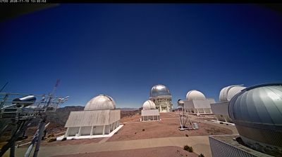
Coquimbo Region combines a dry, sunlit interior with a long Pacific shoreline in a way that reflects its position between the Atacama Desert and central Chile. These inland coordinates lie in Limarí Province, where cultivated valley floors contrast with rugged, sparsely vegetated hills. The Elqui and Limarí river valleys are central to settlement and agriculture, while remarkably clear skies have made the region internationally important for astronomical observatories, including Cerro Tololo. The port city of Coquimbo and the regional capital, La Serena—founded in 1544—provide its principal urban focus. Browse other webcams across Coquimbo Region to place this setting in a wider geographic context.
9 webcams
Among the countries of South America, Chile stands out for its exceptional north-to-south extent between the Andes and the Pacific Ocean. The Atacama Desert in the north is one of the driest places on Earth, while the south reaches into Patagonia, where Torres del Paine National Park is known for its jagged granite peaks, glaciers and lakes. Chile also includes Rapa Nui, the Pacific island famed for its monumental moai statues. In Valparaíso, steep hills, funicular railways and colourful historic neighbourhoods reflect the country’s maritime past; its historic quarter is a UNESCO World Heritage Site. Find related webcams in the surrounding area to build a fuller picture of Chile’s Pacific coast and Andean regions.
100 webcams