 Olsany: Domov Paprsek Olšany, příspěvková organizace - Česká pošta - Základní škola a mateřská škola Olšany, okres Šumperk, příspěvková organizace - Olsany u Sumperka - OP papírna Ltd.
Built around a rural settlement in the Jeseníky foothills, Olšany grew into a municipality shaped by fields, wooded slopes and paper-making. Near Šumperk, the settlement occupies open ground at the foot of low hills and combines detached homes, public services, working farmland and industrial premises. Paper has been made in Olšany since 1861, and the OP papírna mill remains a defining part of the local economy. The primary and nursery school, post office and Domov Paprsek care home serve everyday community needs. Olšany’s character rests on the close connection between its agricultural surroundings and manufacturing tradition.
Generated by AI

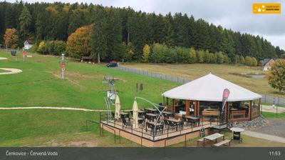




Among the settlements of the South Moravian Region, Olšany stands out for its position on the southern edge of the Drahany Highlands, above the broad Vyškov Gate. The village belongs to Vyškov District and occupies a transition zone where cultivated fields and orchards meet woodland, with Brno to the southwest and Vyškov to the east. This is a quiet rural part of Moravia, shaped by local roads and the rolling terrain between the highlands and lowland corridor. The Czech name Olšany is connected with olše, or alder, reflecting the vegetation-based place names long established in the Czech countryside. Explore further webcams from South Moravia to widen your view of the Olšany area.
2 webcams
South Moravian Region has acted as a cultural crossroads within the Czech lands since the Middle Ages. Brno, Czechia’s second-largest city, is its urban centre, with Špilberk Castle recalling its long strategic role. The region extends across the warm lowlands of the Morava and Dyje rivers, where vineyards shape the countryside around Mikulov and Znojmo. To the north, the Moravian Karst is known for its limestone caves and the Macocha Abyss. The Lednice–Valtice Cultural Landscape, a UNESCO World Heritage Site, combines formal estates, follies and parkland near the Austrian border. Continue with other webcams from the area to see how this part of South Moravia connects regionally.
93 webcams
The terrain of Czechia ranges from fertile lowlands in southern Moravia to mountain ridges along the northern frontier, giving this Central European country a distinctly varied geography. The Vltava runs through Prague before joining the Elbe, while the Krkonoše form part of the border with Poland and include Sněžka, Czechia’s highest mountain. Prague’s historic centre, with Prague Castle and Charles Bridge, reflects the city’s long role as a political and cultural centre. Beyond the capital, Bohemia is known for spa towns and brewing, and Moravia for wine-growing traditions. View additional webcams nearby to better understand how Czechia relates to its Central European surroundings.
1.4K webcams