 Zapoge: A2/E61, Karavanke - Ljubljana, Torovo
Among the places of the Ljubljana Administrative Unit, Zapoge stands out for its position beside Slovenia’s A2 motorway, a principal route between Ljubljana, Kranj and the Karavanke crossing into Austria. The settlement lies on the open northern side of the Ljubljana Basin, where farmland and tree belts meet a major transport corridor. The Sava flows through the wider basin, while the Kamnik–Savinja Alps form the northern mountain chain of this part of Slovenia. Ljubljana, the national capital and historic administrative centre, is the principal urban destination to the south. Zapoge belongs to a landscape shaped by rural settlement as well as close links between central Slovenia and Upper Carniola.
Generated by AI



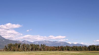

Zapoge lies between the Sava River plain and the foothills of the Kamnik–Savinja Alps in central Slovenia, a setting that has kept this small settlement closely connected to farmland and the wider Ljubljana area. It belongs to the traditional region of Upper Carniola, one of Slovenia’s historic cultural regions, where rural villages remain an important part of the landscape. The nearby towns of Vodice and Medvode link the area with Ljubljana while preserving its quieter, low-rise character. See how Zapoge relates to central Slovenia by browsing webcams nearby.
2 webcams
Upravna Enota Ljubljana stretches from the Sava River to the wooded Dinaric foothills south of the capital, encompassing the lowlands of the Ljubljana Basin and the city’s suburban fringe. At its centre lies Ljubljana, Slovenia’s political and cultural capital, arranged along the Ljubljanica River. The riverfront is defined by the Triple Bridge and the Central Market, both closely associated with architect Jože Plečnik, while Ljubljana Castle stands on the hill above the old town. Beyond the urban core, settlements, farmland and forest connect the basin with karst country to the south. Explore nearby webcam locations that provide complementary perspectives on Ljubljana and central Slovenia.
67 webcams
Slovenia occupies a meeting point of the Alps, the Pannonian Plain, the Dinaric mountains and the Adriatic coast in south-central Europe. The Julian Alps rise in the northwest, where Triglav is the country’s highest mountain, while the Soča River is known for its clear turquoise water. Karst terrain has shaped caves such as Postojna Cave and the Škocjan Caves, a UNESCO World Heritage site. Ljubljana combines a riverside old town with works by architect Jože Plečnik; farther east, wine-growing regions and thermal springs add another dimension. Slovenian food reflects Alpine, Mediterranean and Balkan influences. Find related webcams in the surrounding area to build a fuller picture of Slovenia and the northern Adriatic.
782 webcams