 Boise: Air Quality Camera
Boise occupies a broad river valley in southwestern Idaho, framed to the north by the Boise Foothills. The Boise River has shaped a green corridor of parks and paths through the city, while the surrounding ridges mark the transition from the urban plain to higher country. Idaho’s capital was founded in 1863, and its centre brings together state government, cultural venues and Boise State University. Boise remains a relatively low, spread-out city with close access to outdoor recreation: the foothills contain an extensive trail network, and the Boise River Greenbelt follows the waterway through town. Agriculture and irrigation still shape the wider Treasure Valley.
Generated by AI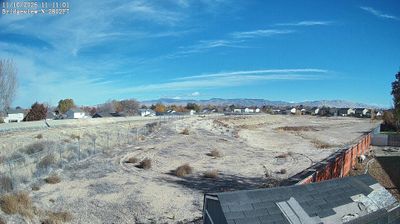



Among Idaho’s cities, Boise stands out for its setting on the Boise River below the dry, trail-lined Boise Foothills. As Idaho’s capital and largest city, it is the commercial and civic centre of the Treasure Valley, a broad urban and agricultural corridor in the state’s southwest. The Idaho State Capitol, completed in 1920, anchors downtown, while the Basque Block reflects a community whose restaurants, museum and cultural events give Boise a distinctive identity in the American West. Paths along the river connect parks and neighbourhoods, and the foothills rise directly beyond the city. Continue with other webcams from the area to see how this part of Idaho connects across the Treasure Valley.
1 webcam
Idaho stretches from the Canadian border to the Utah and Nevada state lines, encompassing forested Rocky Mountain country, broad river valleys, and the Snake River Plain. Central Idaho includes the Wood River Valley, home to the Sun Valley area and its long-established ski culture, with the Sawtooth Range rising to the north. The Snake River crosses southern Idaho, shaping irrigated agriculture, hydropower, and communities along its course. Idaho is also widely associated with potato farming, supported by fertile volcanic soils across the plain. Browse additional webcams from central Idaho to extend your view of the Wood River Valley and the state’s mountain country.
38 webcams
The Atlantic, Pacific and Gulf coasts define much of the United States — their ports, fisheries and trade routes have long tied the country’s economy to the wider world. Between them, the Rocky Mountains, Great Plains and Mississippi River basin form sharply different regions, from high western ranges to broad agricultural heartlands. Cities carry much of the national story: New York’s Statue of Liberty, a gift from France dedicated in 1886, remains an enduring symbol, while Washington, DC concentrates major federal institutions. Indigenous nations have shaped these lands for millennia, and their living cultures remain essential to the country’s identity. Find related webcams in the surrounding areas to build a fuller picture of the United States.
32K webcams