 Bukowina Tatrzanska: Centrum Rekreacji i Rehabilitacji RYSY - Gerlachovský štít
Bukowina Tatrzańska occupies a rolling ridge in Poland’s Podhale region, on the northern foothills of the Tatra Mountains. Scattered homes, guesthouses and pastureland give the settlement a distinctly rural highland character, while the nearby Centrum Rekreacji i Rehabilitacji RYSY forms part of its visitor infrastructure. Podhale is the homeland of the Górale, whose folk music, dress and timber-building traditions remain an important part of local identity. Beyond the Polish-Slovak border rises Gerlachovský štít, at 2,655 metres the highest summit in both the Tatras and the Carpathian Mountains.
Generated by AI


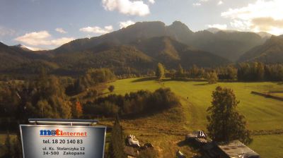

Bukowina Tatrzańska occupies an elevated ridge in Podhale, on the northern side of the Tatra Mountains in Lesser Poland. The village belongs to the Polish highland region known for its Górale traditions, expressed through regional music, dress and timber architecture. Its Dom Ludowy is an important local cultural venue and regularly hosts folk events, including the Góralski Carnival. Bukowina is also home to the Termy BUKOVINA thermal complex, while routes through Podhale lead towards nearby Tatra settlements and mountain trails. Continue with other webcams from the area to see how this part of Lesser Poland connects regionally.
1 webcam
The Vistula valley and the Carpathian foothills shape much of Lesser Poland Voivodeship, linking Kraków’s metropolitan life with farming districts and mountain tourism along its southern edge. Kraków, Poland’s former royal capital, remains the cultural centre: Wawel Castle and the medieval Old Town stand above the river, within a UNESCO World Heritage-listed historic core. Farther south, the Dunajec cuts through the Pieniny, while the Tatra Mountains form a highland frontier with Slovakia. The Wieliczka Salt Mine, worked from the Middle Ages, recalls the importance of salt to the old Polish state. Move on to other webcams in the region to compare landscapes and settings around Lesser Poland Voivodeship.
82 webcams
Poland stretches from the Baltic Sea coast in the north to the Carpathian Mountains along its southern frontier, encompassing broad lowlands, lake districts and upland ranges. The Vistula, the country’s longest river, links Kraków and Warsaw before reaching the Baltic near Gdańsk, while the Masurian Lake District is defined by a dense network of lakes. Kraków’s historic centre, including Wawel Castle, recalls Poland’s former royal capital; Warsaw’s rebuilt Old Town speaks to the city’s recovery after the Second World War. The Białowieża Forest preserves one of Europe’s last primeval lowland forests and is home to European bison. Follow how Poland’s regions relate to one another by browsing webcams across the country.
718 webcams