 Little Mountain: Quart -a-Nancy Point - Manchioneel Bay - Cistern Point - Cooper Island
Tucked along the southern shore of Sir Francis Drake Channel, Cooper Island is a place whose character is shaped by sheltered bays, rocky points and steep tropical slopes. Manchioneel Bay is the island’s main anchorage and shoreline resort area, while Cistern Point and Quart-a-Nancy Point define stretches of its indented coast. Cooper Island lies south of Tortola in the British Virgin Islands, a British Overseas Territory. At Manchioneel Bay, Cooper Island Beach Club provides the island’s small hospitality centre, with accommodation and a restaurant. Reefs and the channel waters form part of the maritime setting that draws sailors travelling between the islands.
Generated by AI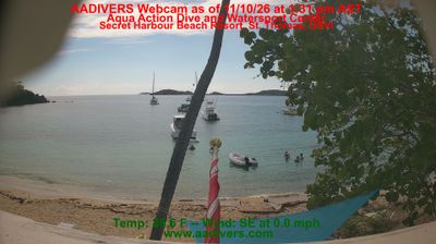


Tucked into the low hills beside Trellis Bay on Beef Island, Little Mountain is a place whose character is shaped by the compact, island terrain of the British Virgin Islands. This small locality sits close to Tortola, while the Sir Francis Drake Channel runs south of both islands toward the smaller cays. Beef Island is connected to Tortola by the Queen Elizabeth II Bridge and is home to Terrance B. Lettsome International Airport, the territory’s main air link. Trellis Bay is known for its sheltered water and its Full Moon Party, a local gathering associated with fire sculptures. Browse additional webcams from Beef Island and Tortola to extend your view of the British Virgin Islands.
1 webcam
The Caribbean Sea and the volcanic slopes of Guana Island define much of Other British Virgin Islands — sheltered waters and close inter-island passages make sailing and marine tourism important to this scattered territory. At these coordinates, Guana lies north of Tortola in the northeastern Caribbean. Its ridges, dry tropical vegetation and beaches provide a quieter counterpoint to Tortola’s larger settlements and road network. The British Virgin Islands are a British Overseas Territory, with English as the official language. See how Guana Island fits within the wider island chain north of Tortola by browsing webcams nearby.
1 webcam
British Virgin Islands combines steep volcanic highlands with low-lying coral terrain in a way that reflects its position within the northeastern Caribbean. The archipelago lies east of Puerto Rico and includes Tortola, Virgin Gorda, Jost Van Dyke and Anegada; the Sir Francis Drake Channel runs between Tortola and the islands to its south. Road Town on Tortola is the capital, while Virgin Gorda is known for The Baths, where enormous granite boulders form pools and passageways at the shore. Sailing, reef diving and beach life are central to the islands’ appeal, alongside the legacy of plantation-era settlement and maritime trade. Browse additional webcams from the surrounding area to extend your view of the British Virgin Islands.
1 webcam